Ground track
The sub-satellite ground track: the orbit projected to the point directly beneath the satellite at each epoch, emitted as a geodetic polyline that floats at the satellite's own height over the correct ground position.
Off by default — and why
ground_track is off unless you ask for it. The ground track is the only conversion that needs
the inertial → Earth-fixed → geodetic rotation (precession / nutation / Earth-orientation), which
loads astropy transitively. Keeping it opt-in means the core orbit-path conversion
stays light: a plain to_czml(trajectory) never loads that machinery.
The rotation and the WGS84 geodetic projection are delegated to orbit-formats — gmat-czml carries no Earth-orientation code of its own — so the accuracy is rigorous and there is no second implementation to keep in sync.
What the converter does
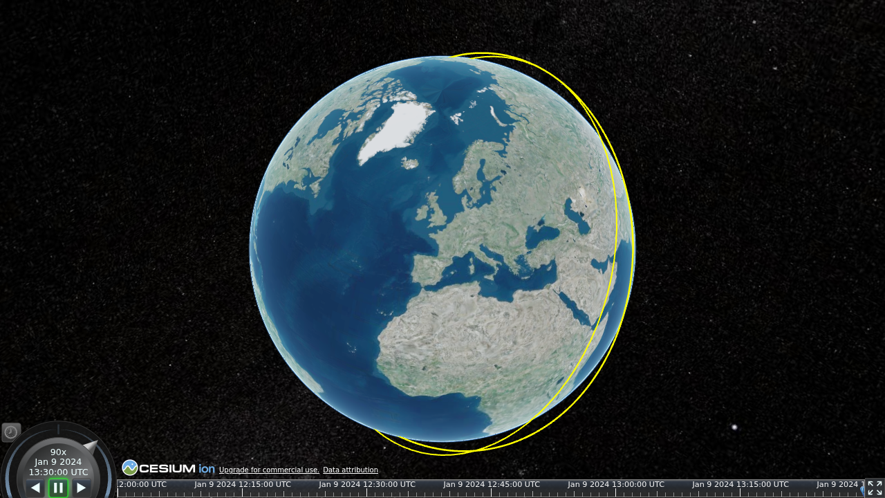
The geodetic polyline. The sub-satellite longitude / latitude / height series becomes a CZML
polyline of cartographicDegrees — [lon, lat, height, …], longitude and latitude in degrees,
height in metres. The track follows the satellite's own geodetic height, so it floats over the
correct ground position rather than being clamped to the surface, and uses the GEODESIC arc type
so each segment follows the shortest ground path between samples.
The antimeridian split. A track crossing ±180° longitude is broken into contiguous segments, each its own polyline, with an interpolated seam point placed exactly on the dateline at both ends of the break — so the rendered track neither draws a spurious line back across the globe nor leaves a gap at the crossing.
Earth only. The projection is WGS84 / Earth-fixed, so the ground track is Earth-only. A trajectory declared about another central body is rejected rather than mis-projected; an undeclared body is accepted, since every recognised frame is already an Earth frame.
Packets
A single-segment track is emitted as one packet, <object>/groundtrack. A track split at the
antimeridian numbers its segments <object>/groundtrack/0, <object>/groundtrack/1, …. A
degenerate track with no renderable segment yields no packets.
Styling
The ground track's colour and width come from the supplied Style's track
field; the sat-default default is the orbit trail's yellow, drawn a touch heavier so it reads
clearly against the globe. See Styling for presets and customization.
Viewing over an imagery underlay
A ground track reads especially well over street-map or satellite imagery. CZML carries no base
imagery, so the underlay is chosen in the viewer, not the document — see
Imagery underlay (OSM / Mapbox). Because the
track floats at the satellite's own height, it aligns with the underlay seen from straight overhead;
to make it hug the imagery in a tilted view, drape it with clampToGround (the bundled viewer's
Clamp ground track to surface checkbox).